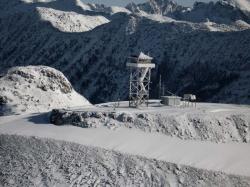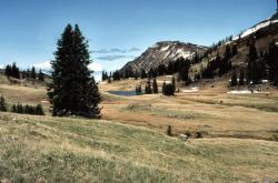
Photos in the Doubly happy is the one for whom lofty mountain tops are within reach album of Badger Badger has a total of 122 photo album. You can view a list of the albums. The album is sorted by Date, click to sort by name. You are viewing the detailed list, click to switch to the brief one. This album contains 22 photos. Pasayten Wilderness from Slate Peak lookout
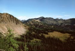
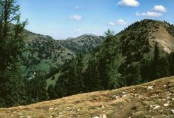
 Pasayten Wilderness is one of the largest wilderness areas in Washington State, and covers some 531,539 acres of mountainous country. Its northern edge crosses the U.S./Canadian border, while to the south it extends to Methow Valley. Pasayten contains 600 miles of trails (many of them deceptively gentle at the start and progressively labor-intensive as they crawl up endless switchbacks into high country), deep canyons, high mountain peaks, and an abundance of wildlife that includes elk, mule deer, black and white tail deer, moose, mountain goats, bighorn sheep, cougar, wolverines, ermine and weasles, the fabled gray wolf and grizzly bears. Skirting more than 50 miles of Canada's border and encompassing the crest of the Cascades, this big piece of very wild country is also home to the largest population of lynx in the Lower 48 states. This incredible wilderness boasts almost 150 peaks that reach over 7,500 feet in elevation, 160 or more bodies of water, and at least as many waterways, some fierce enough to have carved incisive canyons with sheer walls. Rugged ridges in the west flatten into park-like plateaus toward the east, with deep drainages on both sides. Its diverse forest changes from vegetation typical of western Washington (fir, cedar, western hemlock) to growth typical of eastern Washington (fir, pine, larch). Most of my ventures into the Pasaytens started at Billy Goat trail head 20-some miles north of Winthrop, traveling north, crisscross fashion, over the peaks and ravines to the Canadian border and back over the course of ten to twelve days with a base camp at Larch Pass. If you visit, you will find the Pasaytens to be incredibly open, vast, easy to travel in most places, stunningly beautiful, full of panoramic views, and lonesome in such a way as you'e never known before. For people are not common to see in these parts like they are elsewhere. Expect to experience a mix of sun, rain, snow, booming thunder and lightning along the way. And silence. Incredible, moon and starlit silence with an eerily beautiful wolf howl somewhere off in the wooded distance. Photo credit: Brianhe 16 Mar 2012 at 5:12AM Jack Mountain above Ross Lake
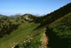
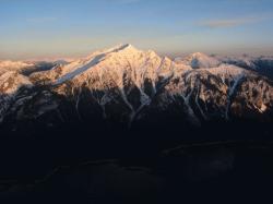 Photo credit: John Scurlock I first travelled in the Pasayten as an impressionable 19-year old backpacker on the PCT in August of 1973. I recall my thought then, that although I had already spent five weeks alone in the wild areas of the Cascades farther south, I was about to enter true wilderness - silent, vast, and mysterious. Over the years I have visited many of the Pasayten's most remote areas; yet to this day I regard the Pasayten with that same feeling. I could not have imagined that I would be photographing it someday during winter from the air, and so I consider myself most fortunate to be able to share these images now with you. John Scurlock March 16, 2007 16 Mar 2012 at 12:43AM Well worn trail
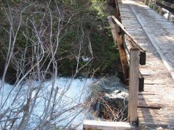
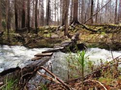
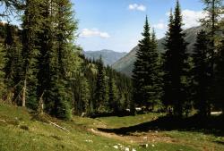
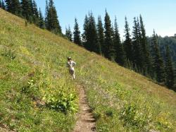
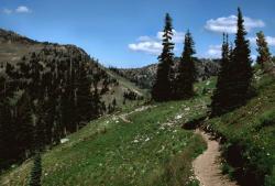 These deeply etched trails are the "roads" of the high country. Horseback or foot travel, the only means of spanning the distance from one point to the next. Life elsewhere quickly becomes forgotten as your step slows to allow the cold, sweet piney air warm your soul as you inhale it. The Pasaytens are almost magical that way. 16 Mar 2012 at 5:45AM Trails in the distance
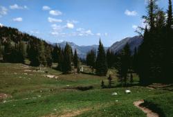
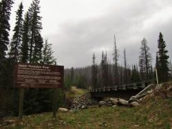
 Vehicles are illegal in the alpine, so all "roads" are really pack trails, made by years of pack animals and mankind trampling the trail into a single lane highway of sorts. Interestingly, these trails are somewhat maintained and you can pick up intricate maps of these roads at local ranger stations. 16 Mar 2012 at 6:32AM Larch Pass
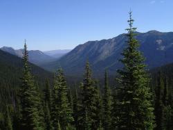
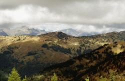
 Taken from a trail guide for Larch: Activity Type: Hiking Nearby City: Winthrop Length: 55 total miles Elevation Gain: 9,700 feet Trail Type: Loop Skill Level: Moderate Duration: 5-7 days (if on foot - plan on just 1 day on horseback) Season: Usually open mid- to late July/late September to early October (they somehow neglect to tell you to expect snow more or less during the accessable times lol. The middle two weeks of August is the closest thing to summer Pasayten ever sees and is often the only window for the wildflowers to bloom. Trailhead Elevation: 4,800 feet 16 Mar 2012 at 6:24AM Looking back
 Larch Pass is a little over 27 miles in (55 miles round trip). If you decide high country camping isn't for you, or find a bear in your camp, its a little far to hike back at this point. Even for a horse. 16 Mar 2012 at 6:36AM Solice
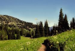
 One of my two oldest girls here (embarassed to say I don't remember which one) around 1995 or 6. It's been more than a few years since I've been back to the Pasayten's, but they remain ever near in my heart. This will always be "home" in such a grand way. 18 Mar 2012 at 6:44PM Mulie
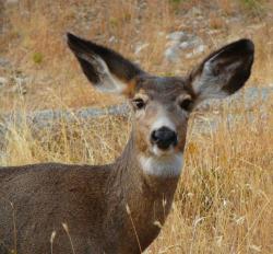 Named for their larger than life ears, mulies can be found across the northern Cascades. 16 Mar 2012 at 1:44AM White Tail Deer
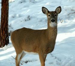 Far larger than the white tails I have seen near Tahoe, this is an exceptionally nice Cascadian doe. 16 Mar 2012 at 1:48AM |
©2000-2026 GoldToken.com LLC. All rights reserved. |